Alaska Storyteller Photography

© Robert M. Braley Jr., Photographer

Home

Contact

About

Policy/Copyright

Photo Sizes

links

Animals

Animals 2

Albatrosses

Bats

Bears

Black Bear

Birds

BitternsHeronsEgr

Deer

Polar Bear

Beaver

bison

Caribou

CaracarasFalcons

Carnivorans

Cetaceans

Comorants

Dall Sheep

DucksGeeseSwans

Fish

Frigatebirds

Canada Goose

Grebes

HawksKitesEagles

Orca

PartridgesGrouse

Pelicans

Pikas Hares Rabbits

Raccoons

redwingedblackbird1

Loons

Mammals

Moose

Mountain Goat

Osprey

Primates

Rodents

Seals Sea Lions Walrus

ShearwatersPetrels

Shrews

StormPetrels

Ungulates

Vultures

Weasels

Wildlife

Architecture

Military War

Alaska National Guard

Alaskanized

C-17

T-6G

T-33

P-51 Mustang

KC-135

HH-60

F-86

F-80

C-47

HC-130N

C-130H

C-130E

C-123J

Pearl Harbor

Klamath WWII Radar

Elmendorf AFB

Klamath AFS

George AFB

Ladd AFB

Camp Murray

U-Tapao

US Veteran

AKNG Museum

AKANG Scrapbook

Soldiers of the Mists

Soldiers of the Mists pdf

Floral Still Life

Landscapes

Lifestyle

Skylines

Transportation

MG Midget

Travel

United States

Canada

Equator

Israel

Crete

Alaska

Alaska Highway

Historic Mile 0

Historic Mile 2

Historic Mile 21

Historic Mile 35

Historic Mile 47

Historic Mile 49

Historic Mile 52

Historic Mile 73

Historic Mile 90

Historic Mile 101

Historic Mile 143

Historic Mile 148

Historic Mile 175

Historic Mile 191

Historic Mile 234

Historic Mile 300

Historic Mile 375

Historic Mile 392

Historic Mile 422

Historic Mile 456

Historic Mile 496

Historic Mile 514

Historic Mile 588

Historic Mile 627

Historic Mile 635

Historic Mile 649

Historic Mile 650

Historic Mile 710

Historic Mile 721

Historic Mile 733

Historic Mile 797

Historic Mile 804

Historic Mile 836

Historic Mile 905

Historic Mile 906

Historic Mile 890

Historic Mile 915

Historic Mile 941

Historic Mile 1010

Historic Mile 1016

Historic Mile 1067

Historic Mile 1072

Historic Mile 1083

Historic Mile 1093

Historic Mile 1152

Historic Mile 1164

Historic Mile 1188

Historic Mile 1202

Historic Mile 1221

Historic Mile 1229

Historic Mile 1225

Historic Mile 1249

Historic Mile 1254

Historic Mile 1257

Historic Mile 1264

Historic Mile 1306

Historic Mile 1309

Historic Mile 1314

Historic Mile 1332

Historic Mile 1422

Events

Stock Photography

Royalty-Free RF 0-100

Royalty-Free RF 101-200

Editorial RM 0-100

Business RF

Abstract RF

Architecture RF

Animals RF

Agriculture RF

Editorial RF

Cira 1968 Klamath Air Force Radar Station
Circa 1972 Klamath AFS, CA
Editor/Writer: Robert M. Braley Jr., MSgt (ret) USAF/AKANG
Last Update: July 13, 2011

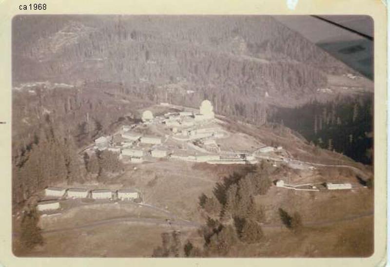
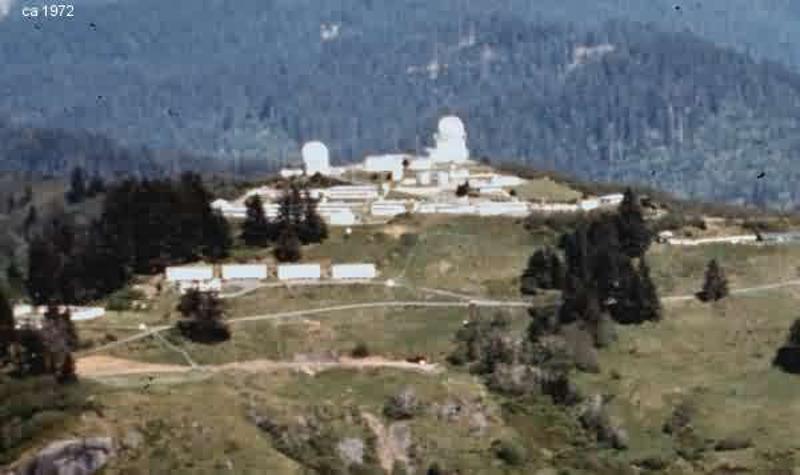
Klamath Air Force Station(AFS) P-33 (Requa), CA Call Sign(s): Engage
Directions: Latitude: 41-33-33 N, Longitude: 124-05-10 W, five miles west of California Highway 101 at Klamath, California. From Klamath, go west on Requa Road to the end of the road. NOTE: most of the buildings (all will be) have been romoved and access to the station property is no longer possible. The Redwood National and State Parks staff and contractors are in the process of removing all buildings and restoring the land to its natural state.

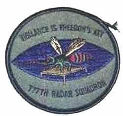
On January 1, 1951 the 777th AC&W Squadron was activated, thus establishing Klamath AFS as Lashup-Permanent site, LP-33, operating an AN/TPS-1B radar. The site then became a part of the Permanent radar network.

Beginning in April 1952, the 777th AC&W Squadron began operating AN/FPS-3 and AN/FPS-4 radars at this northern California coastal site.

In 1956 the Air Force added an AN/GPS-3 to the facility.

By 1958 an AN/FPS-20 and AN/FPS-6 had replaced the initial pair of radars. During the following year, an AN/FPS-6A height-finder radar was added, later modified to an AN/FPS-90. The AN/GPS-3 was removed.

During 1960 the 777th became a SAGE radar squadron.

By the end of 1961, the AN/FPS-20A had been upgraded and redesignated as an AN/FPS-66.

An AN/FPS-26 height-finder radar was added in the 1963/1964 time frame.

By 1966 there was an AN/FPS-27 long-range search radar in operation there, and the AN/FPS-66 was subsequently retired.

The site came under TAC jurisdiction beginning in 1979.

On September 30, 1981 the 777th was in-activated. In the 1980s much property was turned over to the National Park Service. The operations area became a FAA/USAF joint-use facility.

In 1995, the FAA operated an AN/FPS-66A search set in the old AN/FPS-27 tower.

The Klamath / Crescent City radar site has since been 'replaced' by the FAA/USAF JSS site at Rainbow Ridge, CA (J-83A), operating an ARSR-4.

777th Radar Squadron (SAGE) Patch
777th Radar Squadron Patch
777th RADS Patch
NOTE: This website contains affiliate ad links and I will be compensated if you make a purchase after clicking on the links.

Website powered by Network Solutions®