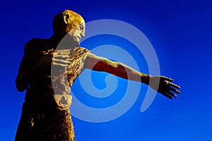
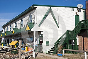
100 Mile House was originally known as Bridge Creek House, named after the creek running through the area. Its origins as a settlement go back to the time when Thomas Miller owned a collection of ramshackle buildings serving the traffic of the gold rush as a resting point for travellers moving between Kamloops and Fort Alexandria, which was 98 miles (158 km) north of 100 Mile House farther along the HBC Brigade Trail. It acquired its current name during the Cariboo Gold Rush where a roadhouse was constructed in 1862 at the 100 miles (160 km) mark up the Old Cariboo Road from Lillooet.
108 Mile Ranch is a residential community of 700 homes situated in the South Cariboo region of British Columbia located in a historic area of ranches and lakes.
Historically, en route to the great Cariboo Gold Rush, a few of the travellers settled here.
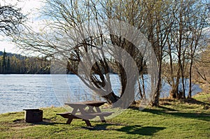
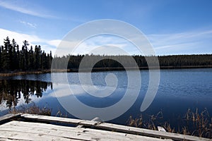
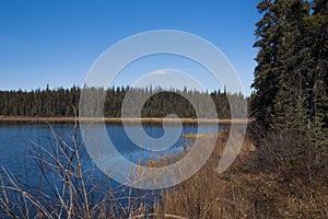
A feature of the 108 community is its green belt lands. Comprising more than 1,500 acres (610 ha) these community parklands include 108 and Sepa Lakes, Walker Valley and many small patches scattered around the ranch.
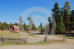
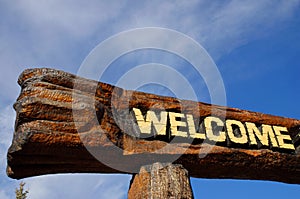
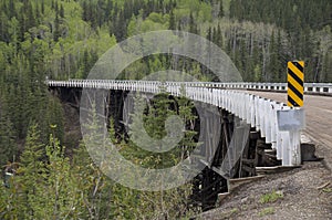
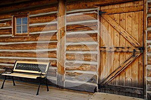
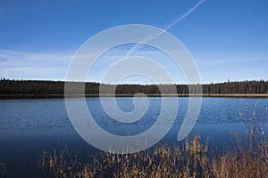
108 Mile Ranch is about 12 kilometres (8 mi) north of 100 Mile House, just off Highway 97. South Cariboo Regional Airport is the regional facility for the South Cariboo. Located on Highway 97, The 108 Heritage Site is a tourist attraction with its growing number of restored buildings, including the largest log barn in Canada.
British Columbia, also commonly referred to by its initials BC, is a province located on the west coast of Canada. British Columbia is also a component of the Pacific Northwest and the Cascadia bioregion, along with the US states of Idaho, Oregon, Washington and Alaska The province's name was chosen in 1858 by members of the Hudson's Bay Company. In 1871, it became the sixth province of Canada. Its Latin motto is Splendor sine occasu ("Splendour without Diminishment").
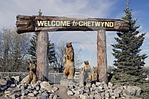
Chetwynd, formerly known as “Little Prairie” was renamed to honor the late Ralph Chetwynd, a British Columbia Minister of Railways. It has a population of about 3,100 with a trading area of 7,000. Chetwynd’s main industries are forestry, mining, natural gas processing and ranching.
Hope, BC – On Highway 1, nestled against the Cascade Mountains on the banks of the FrazerRiver. The FrazerRiver is named after explorer Simon Frazer, the first European to navigate its raging waters. Once a transportation link for wagons and stage coaches traveling the old Cariboo Waggon Road, the FrazerCanyon roadway now transports you through awe-inspiring scenery. Cutting a heart-stopping swath through the Cascade and Coast Mountains, the river creates a valley of lush forests, gorges and mountainside farmlands.
Hells Gate, BC – Continuing on Highway 1, you will find nature at its most magnificent. More than 200 million gallons of water surge through this narrow 110 foot gorge every minute – twice the volume of Niagara Falls. International Fishways flank this gorge, and rafters bravely shoot the rapids.
Lytton, BC – The Frazer and ThompsonRivers meet here to create a dramatic surge that has earned this area its reputation as the “Rafting Capital of Canada.” Devil Gorge and Witch’s Cauldron swirl and dip to heights of 15 feet. Fishing, hiking and camping are also close by.
British Columbia Heritage Discovery (east), Lakes and Trails (west), and Coast Cariboo (east)
Lillooet, BC – Continuing on Highway 1 to 99 north, Official start (mile 0) of the old and pan for gold.
Cash Creek, BC - Continuing on Highway 99 north, turn south on highway 97 for a short side trip to Cash Creek. Go north on highway 97 to…
Clinton, BC – Cowboy town on highway 97. Arid desert settings close-by.
93 Mile, BC – (side trip for fishing) You can turn east on highway 23 (better known as “The Fishing Highway”) toward Little Fort where there are over 100 lakes and fly-fish or troll for Trout, Burbot and Kokanee. Good spot for wildlife photography. I will be getting back on highway 23 west and backtrack to highway 97 north to continue on to 100 Mile.
100 Mile House, BC
108 Mile Heritage Site, BC
WilliamsLake, BC (FrazerRiver)
British Columbia: Heritage Discovery (east), Lakes and Trails (west) routes
Quesnel, BC (side trip to Bakerville, BCGoldTown)
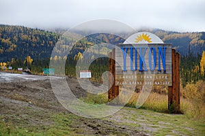
British Columbia: Great Northern (east) route.
Prince George, BC (FrazerRiver, Pulp Mill, Lumber, vintage railroad collection, Huble Homestead 1900s).
Pine Pass, BC
Bijoux Falls, BC
Chetwynd, BC (hwy 97 and 29)
Hudson’s Hope, BC (Side trip north on highway 29) “Land of the Dinosaurs” at Hudson’s Hope Museum and W.A.C. Bennett Dam; one of the largest earth-filled structures in the world. Head back to highway 97 and head east into Dawson Creek, BC.
British Columbia, also commonly referred to by its initials BC, is a province located on the west coast of Canada. British Columbia is also a component of the Pacific Northwest and the Cascadia bioregion, along with the US states of Idaho, Oregon, Washington and Alaska The province's name was chosen in 1858 by members of the Hudson's Bay Company. In 1871, it became the sixth province of Canada. Its Latin motto is Splendor sine occasu ("Splendour without Diminishment"). Ref. Wikipedia
The capital of British Columbia is Victoria, the fifteenth-largest metropolitan region in Canada, named for the Queen who created the Colony of British Columbia. The largest city is Vancouver, the third-largest metropolitan area in Canada, the largest in Western Canada, and the second-largest in the Pacific Northwest. In October 2013, British Columbia had an estimated population of 4,606,371 (about 2.5 million of whom were in Greater Vancouver). The province is currently governed by the BC Liberal Party, led by PremierChristy Clark, who became leader as a result of a leadership convention vote on February 26, 2011, and who led her party to an election victory on May 14, 2013. Ref. Wikipedia
British Columbia evolved from British possessions that were established in what is now British Columbia by 1871. First Nations, the original inhabitants of the land, have a history of at least 10,000 years in the area. Today there are few treaties and the question of Aboriginal Title, long ignored, has become a legal and political question of frequent debate as a result of recent court actions. Notably, the Tsilhqot'in Nation has established Aboriginal title to a portion of their territory, as a result of the recent Supreme Court of Canada decision (Tsilhqot'in Nation v. British Columbia). Ref. Wikipedia
B.C.'s economy is diverse, with service producing industries accounting for the largest portion of the province's GDP. It is the endpoint of transcontinental railways, and the site of major Pacific ports that enable international trade. Though less than 5% of its vast 944,735 km2 (364,764 sq mi) land is arable, the province is agriculturally rich, (particularly in the Fraser and Okanagan valleys), because of milder weather near the coast and in certain sheltered southern valleys. Its climate encourages outdoor recreation and tourism, though its economic mainstay has long been resource extraction, principally logging, farming, and mining. Vancouver, the province's largest city and metropolitan area, also serves as the headquarters of many western-based natural resource companies. It also benefits from a strong housing market and a per capita income well above the national average. While the coast of British Columbia and certain valleys in the south-central part of the province have mild weather, the majority of its land mass experiences a cold-winter-temperate climate similar to that of the rest of Canada. The Northern Interior region has a subarctic climate with very cold winters. The climate of Vancouver is by far the mildest winter climate of the major Canadian cities, with nighttime January temperatures averaging above the freezing point. Ref. Wikipedia
The capital of British Columbia is Victoria, the fifteenth-largest metropolitan region in Canada, named for the Queen who created the Colony of British Columbia. The largest city is Vancouver, the third-largest metropolitan area in Canada, the largest in Western Canada, and the second-largest in the Pacific Northwest. In October 2013, British
Columbia had an estimated population of 4,606,371 (about 2.5 million of whom were in Greater Vancouver). The province is currently governed by the BC Liberal Party, led by PremierChristy Clark, who became leader as a result of a leadership convention vote on February 26, 2011, and who led her party to an election victory on May 14, 2013.
British Columbia evolved from British possessions that were established in what is now British Columbia by 1871. First Nations, the original inhabitants of the land, have a history of at least 10,000 years in the area. Today there are few treaties and the question of Aboriginal Title, long ignored, has become a legal and political question of frequent debate as a result of recent court actions. Notably, the Tsilhqot'in Nation has established Aboriginal title to a portion of their territory, as a result of the recent Supreme Court of Canada decision (Tsilhqot'in Nation v. British Columbia).
B.C.'s economy is diverse, with service producing industries accounting for the largest portion of the province's GDP. It is the endpoint of transcontinental railways, and the site of major Pacific ports that enable international trade. Though less than 5% of its vast 944,735 km2 (364,764 sq mi) land is arable, the province is agriculturally rich, (particularly in the Fraser and Okanagan valleys), because of milder weather near the coast and in certain sheltered southern valleys. Its climate encourages outdoor recreation and tourism, though its economic mainstay has long been resource extraction, principally logging, farming, and mining. Vancouver, the province's largest city and metropolitan area, also serves as the headquarters of many western-based natural resource companies. It also benefits from a strong housing market and a per capita income well above the national average. While the coast of British Columbia and certain valleys in the south-central part of the province have mild weather, the majority of its land mass experiences a cold-winter-temperate climate similar to that of the rest of Canada. The Northern Interior region has a subarctic climate with very cold winters. The climate of Vancouver is by far the mildest winter climate of the major Canadian cities, with nighttime January temperatures averaging above the freezing point.